
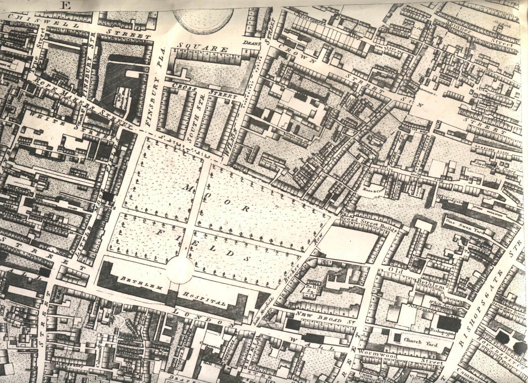
Map showing Bethlem Hospital, Moorfields, in 1799
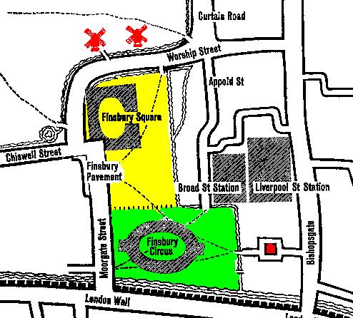
The sketch map, underneath the main map, locates the old and new Bedlams in relation to the 1751 St Luke's Hospital and modern streets and buildings.
Opposite Old Bethlem is Devonshire Street where, at this time, Quakers from all over Britain gathered for their Yearly Meeting every spring. The Yorkshire Quaker family of Tuke were developing new methods of confining and treating the insane.
|
In this sketch map, the position of modern streets and buildings is imposed
on the pattern of Moorfields open spaces in a
1559 map. The
area coloured
green is the area that came to be known as Lower Moorfields. The
1766-1815 Bedlam
(shown on the
top map)
was on the south of this. The position of the
1377-1666 Bedlam
is shown by the red square. The area coloured yellow came to
be known as Upper Moorfields. The windmills are near the position that the
first St Luke's
Hospital
was built in 1751
The sketch map is part of one published in Moorfields in 1559, published by the London Museum in 1963. I added the colours. |
Links to other maps
Curtain Road, at the top of the sketch map, leads north to Hoxton and the Hoxton Madhouses Windmill Street When Charnel chapel, St. Paul's, was taken down by the Protector Somerset, in 1549, more than 1,000 cart-loads of bones were removed to Finsbury Fields, where they formed a large mound, on which three windmills were erected. It was from these mills that the street obtained its name. (Leigh Hunt.) St Luke's Hospital was originally based in a converted old foundry in Windmill Street, Upper Moorfields. |